Tell Tayinat: Capital of the Kingdom of Palistin in the Amuq Valley
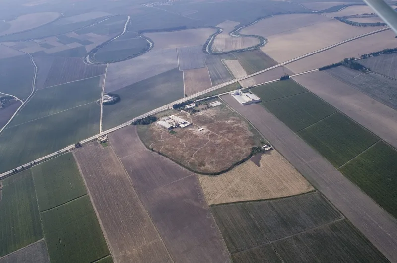
In the Amuq Valley on the eastern bank of the Orontes River, approximately 25 km southeast of Antakya, rises the broad, low tell of Tell Tayinat. Buried beneath layers of earth lies the capital of the Late Hittite (Neo-Hittite) Kingdom of Palistin, including the city of Kunulua (Kinalua)—later the Assyrian province of Unqi. The site is notable for several features: its monumental Neo-Hittite architecture, a statue of King Suppiluliuma with a bilingual inscription, a temple whose layout resembles the biblical Temple of Solomon, and the fact that descendants of the Philistines lived here thousands of kilometers from their “classical” homeland.
History and Discovery
The site has been studied since the 1930s. Robert Braidwood of the Oriental Institute in Chicago conducted four field seasons between 1935 and 1938, laying the foundation for the chronology and stratigraphy of the entire Amuq region. After a long hiatus, work resumed in 2003 under the Tayinat Archaeological Project led by Timothy Harrison (University of Toronto). It was this expedition that discovered the temple with inscriptions, the statue of Suppiluliuma, and fragments of the Esarhaddon Treaty.
Tell Tayinat is proposed to be identified with the settlement of Alalaḫu, mentioned in 3rd-millennium BCE texts from the Ebla archive; during the Iron Age, Kunulua—the capital of the kingdom of Palistin (Patin/Patina)—was located here, and after the Assyrian annexation, it served as the residence of the provincial governor. Nearby lies Tell Atchana (ancient Alalakh)—the cities formed a unified historical landscape of the Amuq Valley.
What to see and archaeological finds
In antis temple
The main sensation of the excavations is a Neo-Hittite temple with a layout strikingly reminiscent of the description of Solomon’s Temple in Jerusalem: an “in antis” type with three rooms, a portico, columns, and an altar at the rear. This provides comparative material for biblical archaeology and confirms that this architectural type was widespread throughout the northern Levant in the first half of the 1st millennium BCE.
Statue of King Suppiluliuma
In 2012, a monumental statue of King Suppiluliuma, approximately 1.5 m tall and bearing a hieroglyphic-Luwian inscription, was discovered. This is the Late Hittite king of Palistin (not to be confused with the famous Suppiluliuma I, king of the great Hittite Empire), who ruled in Kunulua in the 9th century BCE. The statue was found at the entrance to the palace complex and is now housed in the Hatay Archaeology Museum.
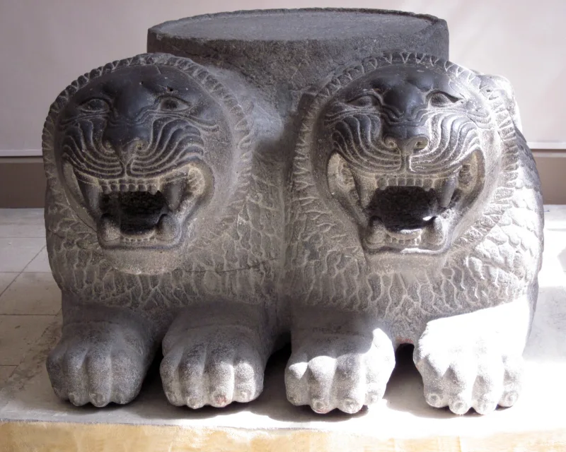
Bit-hilani-style palaces
Several palaces of the classical Syrian bit-hilani type have been excavated at the citadel—featuring a ceremonial portico supported by columns and a characteristic layout of residential and service rooms. This is typical of the architecture of the North Syrian city-states of the 1st millennium BCE.
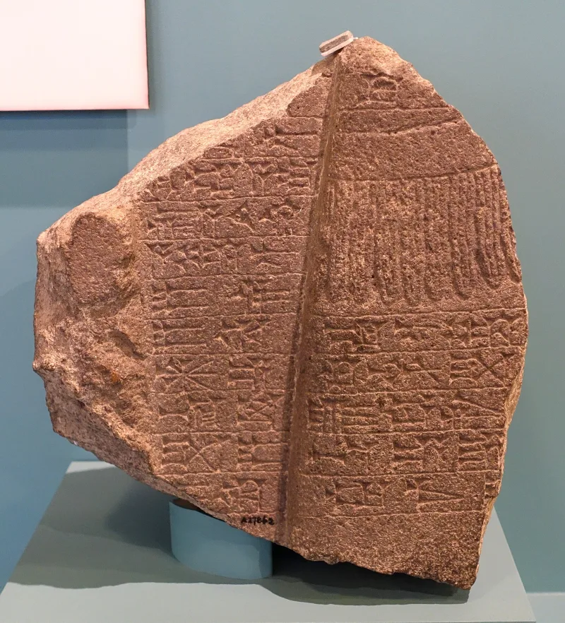
The Esarhaddon Treaty and Cuneiform Tablets
Among the finds are fragments of the Esarhaddon Succession Treaty, strikingly similar in form to Assyrian vassal treaties with other kingdoms in the region. Astronomical texts and fragments related to provincial administration have also been discovered.
Connection to the Philistines
The name of the kingdom Palistin (Walistin/Patin) and the material culture of the site point to a connection with the “Sea Peoples” and, possibly, with the same groups that settled in the southern Levant as the biblical Philistines. This makes Tell Tayinat an important site not only for Hittitology and Assyriology, but also for the study of the “Sea Peoples” of the Late Bronze Age.
Interesting facts
- The Tell Tayinat temple, built on an “in antis” plan, is one of the closest known architectural parallels to the biblical description of Solomon’s Temple.
- The Esarhaddon Succession Treaty found here is virtually identical in form to other Assyrian vassal treaties and helps reconstruct imperial diplomacy of the 7th century BCE.
- The name of the kingdom of Palistin echoes the name of the Philistines—this is an important argument in the debate over the migrations of the “Sea Peoples.”
- Nearby lies Tell Atchana (ancient Alalakh), making the Amuq Valley one of the richest archaeological landscapes in Turkey.
- Excavations in the 1930s led by Robert Braidwood established the chronology still used for the entire Amuq Valley today.
How to get there
Tell Tayinat is located in Hatay Province, 25 km southeast of Antakya, near the village of Tayinat. The most convenient way is by rental car from Antakya: the drive takes 30–40 minutes. Coordinates: 36°14′51″N 36°22′35″E. The nearest airport is Hatay (HTY).
The site itself has minimal infrastructure—it remains primarily an active archaeological site. However, the nearby Hatay Archaeology Museum in Antakya, one of the world’s largest mosaic museums, displays key finds from Tayinat, including the statue of Suppiluliuma. It makes sense to visit the hill first and then spend half a day at the museum.
Tips for travelers
The best time to visit is spring and fall. In summer, the Amuq Valley is stifling, and in winter, rain and mud on the dirt roads are possible. Bring water, a hat, and sturdy shoes.
Keep in mind that Antakya and Hatay Province were severely affected by the February 2023 earthquakes. Before your trip, it’s worth checking the current condition of roads, hotels, and museums—the situation is gradually improving, but it’s essential to verify the basic logistics.
It makes sense to combine a visit to Tell Tayinat with a tour of the Hatay Archaeology Museum, the Monastery of St. Simeon near Samandag, and the Titus Tunnel (Vespasianus-Titus Tüneli) in Çevlik. The Orontes Valley is a distinct, little-known, yet history-rich route at the junction of Anatolia, Syria, and the Levant.